
Imagine a silent, invisible force steadily shifting the ground beneath your feet. This isn’t science fiction; it’s the sobering reality for Leyte Island. The central Philippine Fault, a geological giant, is creeping—a slow but persistent movement that releases built-up stress without the dramatic ruptures of a major earthquake.
The Philippine archipelago, known for its active tectonic setting, is home to numerous fault lines. Unlike the sudden, violent ruptures of major earthquakes, the Philippine Fault on Leyte Island exhibits a more subtle yet equally concerning behavior. It’s slowly sliding past itself, a phenomenon scientists call “creep.”
Recent findings show the fault is moving at a significant pace, with some sections shifting by several centimeters annually. Over the past few decades, the northernmost section has crept at approximately 21 millimeters per year, while the central part moves at around 15 millimeters annually. This movement was tracked through ground surveys of displaced roads and buildings, providing insights consistent with advanced satellite-based techniques.
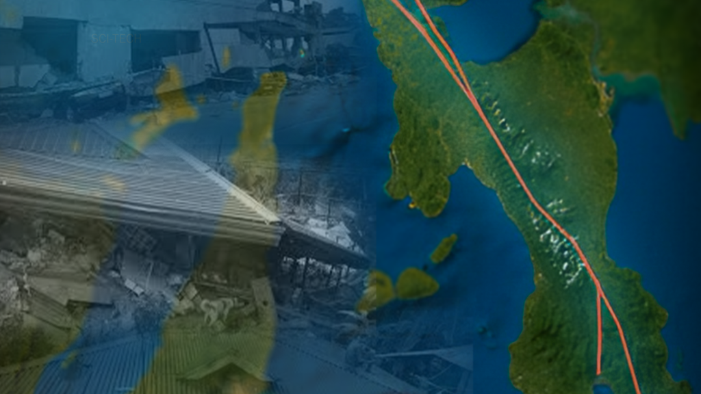
Satellite technology like GNSS and InSAR has uncovered a vast crack in the Earth’s crust stretching over 1,500 kilometers, running parallel to the Philippine archipelago. These tools have confirmed the fault’s aseismic creep, with long-term slip rates reaching 19 millimeters per year. Studies have documented movement ranging between 26 and 47 millimeters annually, offering a detailed picture of this geological activity.
Leyte’s location near active fault lines makes it particularly vulnerable to seismic activity. The island’s geological composition amplifies ground shaking, and many rural structures, often built without modern earthquake-resistant designs, remain at risk. The recent magnitude 1.5 tremor in Javier on November 25, 2024, serves as a sharp reminder of the region’s susceptibility to earthquakes.
Researchers have identified areas where the fault has displaced cultural landmarks, including roads and structures in Poblacion and Salog in Leyte Municipality, and Balinsasayao in Abuyog. At these sites, detailed measurements revealed that ground movement along the fault is more pronounced than earlier satellite observations suggested.
As tectonic plates shift and grind, Leyte’s Philippine Fault is a stark reminder of the Earth’s dynamic forces. Understanding this slow but relentless creep is essential for gauging the region’s seismic risks. By keeping a close watch on its movements, scientists can enhance early earthquake warning systems and improve safety for communities living along the fault’s path.
Article by Kyla Grade de Paz